


|
By clicking Subscribe, I agree to receive advertising and other marketing messages from TGI Source under the terms of the Privacy Policy and User Agreement. |
|
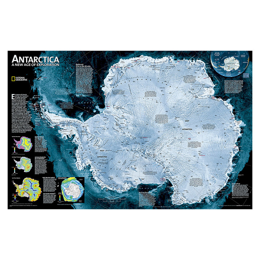
National Geographic Antarctica Satellite Map, Laminated, 31.25" x 20.25"
(Contains 1 Map)
| $19.96 | Retail $24.95 |
- National Geographic Antarctica Satellite Wall Map has a striking view of Antarctica's terrain, compiled from 4,500 satellite scans
- Additional inset maps show surface elevation, ice sheet thickness, velocity of ice flow, and sea ice movement and windflow.
- The map is encapsulated in heavy-duty 1.6 mil laminate which makes the paper much more durable and resistant to the swelling and shrinking caused by changes in humidity.
- Measures 31.25" x 20.25"
Manufacturer:
National Geographic Maps
Item:
NGMRE00620144
UPC Code:
9780792250128
Condition
New
$19.96EA
$24.95
$24.95
Availability
In Stock
You may be also interested
Product description
A striking view of Antarctica's terrain, compiled from 4,500 satellite scans. Additional inset maps show surface elevation, ice sheet thickness, velocity of ice flow, and sea ice movement and windflow.
The map is encapsulated in heavy-duty 1.6 mil laminate which makes the paper much more durable and resistant to the swelling and shrinking caused by changes in humidity. Laminated maps can be framed without the need for glass, so the frames can be much lighter and less expensive.
Specifications
Weight
0.75
Age Group
14+ years
Assembly Required
N
Battery Included
N
Classroom Grade
Grade 9+
Color
Multi
Country of origin
USA
Coverage Percent
31.25" x 20.25"
Device Types
1
Dimension Height
9780792250128
Dimension Length
Maps & Map Skills
Dimension Weigth
25.25
Green Information
9780792250128
Height
2.25
Length
25.25
Material
Paper
MSDS_Indicator
0.75
Operating relative humidity range
N
Post-Consumer Recycled Content Percent
Wall Reference Maps
Pre-Consumer Recycled Content Percent
9780792250128
Print technology
Y
Product Type
Maps & Map Skills
Quantity
USA
Recycled
14+ years
Total Recycled Content Percent
4905000000
Video
2.25
Width
2.25
Product ratings & Reviews
