|
By clicking Subscribe, I agree to receive advertising and other marketing messages from TGI Source under the terms of the Privacy Policy and User Agreement. |
|
National Geographic Night Sky, Stargazer folded Map Pack Bundle, Folded: 4.25" x 9.25" ; Flat: 25.25" x 18.5"
(Contains 1 Night Sky Nrthern Hemisphere; 1 Night Sky Southern Hemisphere)
| $24.95 |
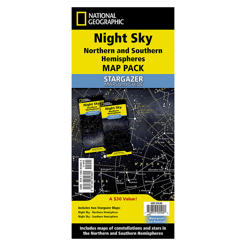
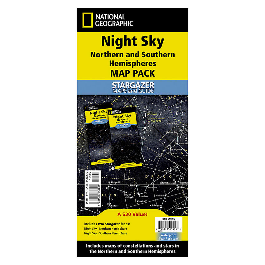
- National Geographic's The Night Sky - Stargazer Map Pack, contains two maps, the Northern Hemisphere is centered on Polaris, the North Star, the Southern Hemisphere is centered near Crux, the Southern Cross.
- As the Earth moves in its orbit around the Sun the constellations in the sky change. The Night Sky maps include four seasonal charts that are specific for each season: spring, summer, autumn, and winter.
- Night Sky Map Pack includes: Night Sky - Northern Hemisphere and Night Sky - Southern Hemisphere
- Every Space Reference map is printed on "Classroom Tough" waterproof, tear-resistant paper.
- Measures 4.25" x 9.25" folded and 25.25" x 18.5" flat
Manufacturer:
National Geographic Maps
Item:
NGMRE01021310B
UPC Code:
749717055995
Condition
New
$24.95EA
Availability
In Stock
You may be also interested
Product description
The Night Sky - Stargazer Map Pack contains two maps, the Northern Hemisphere is centered on Polaris, the North Star, the Southern Hemisphere is centered near Crux, the Southern Cross. The constellations and brighter stars are labeled with their latin names. The map also includes a table of star magnitude or brightness.
As the Earth moves in its orbit around the Sun the constellations in the sky change. The Night Sky maps include four seasonal charts that are specific for each season; spring, summer, autumn, and winter.
The Stargazer Map and Guides are the ideal resource for exploring space from the comfort of your back yard. Each Stargazer Map and Guide is printed on waterproof and tear-resistant material and includes awe-inspiring images of the moon, planets, and deep space. Wherever your eyes wander the sky at night, these maps will help guide you.
Night Sky Map Pack includes:
Night Sky - Northern Hemisphere
Night Sky - Southern Hemisphere
Every Stargazer Map is printed on durable synthetic paper, making them waterproof, tear-resistant and tough — capable of withstanding the rigors of repeated outdoor use.
Specifications
Weight
0.25
Age Group
12+ years
Assembly Required
N
Battery Included
N
Classroom Grade
Grade 7+
Color
Multi
Country of origin
USA
Coverage Percent
Folded: 4.25" x 9.25" ; Flat: 25.25" x 18.5"
Device Types
2
Dimension Height
749717055995
Dimension Length
Maps & Map Skills
Dimension Weigth
11.00
Green Information
749717055995
Height
0.25
Length
11.00
Material
Paper
MSDS_Indicator
0.25
Operating relative humidity range
N
Post-Consumer Recycled Content Percent
Wall Reference Maps
Pre-Consumer Recycled Content Percent
9781566959605
Print technology
Y
Product Type
Maps & Map Skills
Quantity
USA
Recycled
12+ years
Total Recycled Content Percent
4905906052
Video
5.00
Width
5.00
Product ratings & Reviews